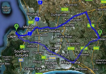
Google have just released Google Maps SA. It’s awesome!
We’ve been able to see satellite images and some road data before. But now there is a lot of road data and you can get automatic directions!
The directions service works amazingly well. I’ve tested it with several routes that I often take and Google invariably got things right – even offering options!
For one test I typed in this exact input:
- V&A Waterfront, Cape Town
- Moyo at Spier, Cape Town
The service quickly offered two routes to Spier (N1 or N2).
It estimates time fairly accurately at about 40 minutes (N1 is slightly quicker even though it is slightly further).
It also offers step by step driving instructions for the route. Like a poor mans GPS. Simply amazing.
View the map yourself to see what I’m talking about.
